As we expand our operations in Scotland, we will share some of the knowledge that helps us to add value to client projects north of the border. Over the next few weeks, we will take a deep dive into where and how conventions and legislation affecting land and property vary in each country, and how these impact surveying best practice.
Across the Border Volume 1: Land Registration Standards
Property law is one of the key areas of divergence when it comes to the Scottish and English legal systems. A key area of difference for surveyors is the method in which land is registered in the two countries.
In England and Wales, HM Land Registry operates under a framework of pragmatism known as the general boundaries rule, which prioritises the identification of land over the precise determination of perimeters. Conversely, the Land Register of Scotland has transitioned towards a rigorous, parcel-based cadastral map system under the Land Registration etc. (Scotland) Act 2012, which mandates a seamless, non-overlapping registered rights.
As surveyors offering the production of registry-compliant plans, it is crucial that the nuances of each system are understood as the technical specifications for scaling, symbology, and submission reflect the fundamentally different approaches to each state’s guarantee of title.
Divergence in Theory
The production of a land registry plan begins with the legal definition of what the map is intended to prove. In the English system, the title plan is essentially a graphic aid to the property description in the register. It identifies the general extent of the land but does not, as a matter of law, determine the exact line of the boundary. In England and Wales most boundaries are general unless they have been formally determined through a specific, high-accuracy application (such as a boundary survey – link). This approach acknowledges the inherent limitations of Ordnance Survey mapping at standard scales, where a line on the map may represent a physical feature but does not completely match the reality.
Scotland on the other hand has moved towards a more absolute geospatial record. The 2012 Act introduced the cadastral map as a statutory component of the Land Register, where every registered plot of land corresponds to a unique “cadastral unit”. The relationship is strictly defined: one registered plot of land equals one cadastral unit, which in turn equals one title sheet. This system is built upon the “no gaps, no overlaps” principle, requiring that no area of land be represented in more than one cadastral unit, with no resultant competition for title. Consequently, a plan compliant with the Land Register of Scotland must facilitate “delineation” on the national cadastral map, a standard of precision that exceeds the “identification” requirement typical of HM Land Registry.
Technical Specifications

Again, when it comes to specification, the English system offers more flexibility and pragmatism, whereas the Scottish system favours precision.
For example, while metric units are preferred by HMLR, they are not mandatory as they are in the Register of Scotland. Plans in both registers must show a north point for orientation, but only RoS mandates a bar scale to identify any distortion caused by copying or digital transmission.
The concept of “surrounding detail” is also vital in both regions but serves different ends. In England, HMLR requires enough detail (roads, junctions, nearby buildings) to ensure the property can be located on the OS map. In Scotland, the requirement is more geometric; plans that lack surrounding detail are categorised as “floating shapes” and are deemed insufficient to delineate the plot on the cadastral map. For complex Scottish titles, dimensioned plans are encouraged to include “proof measurements”, such as diagonals or angles at each change of boundary direction, which allow the registry to verify the survey’s internal consistency.
Visual Conventions
Colour coded line work is relied upon heavily by both registered to convey additional information, but are broadly similar with a few exceptions, as laid out in the table below:
| Symbology / Feature | England (HMLR) Usage | Scotland (RoS) Usage |
|---|---|---|
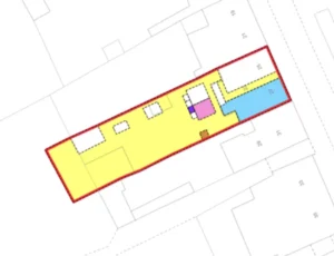
| Main Property Edge | Red (inside boundary) | Red (delineates plot) |
| Benefit of Easement | Brown tinting | Yellow or brown tinting |
| Burden of Easement | Blue tinting | Blue tinting |
| Excluded Land | Green edging/tinting | Green edging (removed unit) |
| Common Areas | Varied (often hatched) | Specific tints (pink/yellow/brown) |
| Boundary Responsibility | T-marks (stem points to owner) | Black arrows (point to legal line) |
Verticality
Each register has evolved a different approach to representing multi story building containing multiple titles.
In England, the registration of a leasehold flat or a multi-level freehold property requires a plan that explicitly defines the level of the property. According to Practice Guide 40 Supplement 5, a lease plan should show the precise extent of the demised property, usually by placing a red edge on the inside surface of the walls of each room, effectively excluding the main structural elements of the building and the common parts like staircases and entrance halls.
Scotland handles vertical subdivisions through a unique statutory mechanism under Section 16 of the 2012 Act, designed to overcome the difficulties of mapping vertical boundaries in a single cadastral unit system. An entire tenement building and all the flats within is represented as a single cadastral unit, known as the “tenement steading”. This unit is represented by a single red edge on the cadastral map.
While there is only one cadastral unit for the building, each flat has its own title sheet and title number. The property description for each flat refers to its location within the tenement steading cadastral unit (e.g. “westmost dwelling house on the first floor”). Geospatial data defining the specific footprint of a flat or its exclusive pertinents is not shown on the cadastral map but is instead treated as “supplementary data” in the individual title sheet. If a flat includes a piece of ground (whether exclusive or common) that is further than 25 metres away, that land cannot be part of the tenement cadastral unit. Instead, it must be created as a separate cadastral unit with its own title sheet; often a “shared plot title sheet” if the land is owned in common. It forces a high level of mapping precision for remote pertinents, ensuring that large tracts of land associated with a tenement building are correctly delineated as separate plots rather than being “hidden” within a broad building reference.
Submission Standards
The technical formats required for submitting plans have diverged as both registries modernise. England continues to rely primarily on high-quality visual representations, while Scotland has moved towards the direct submission of geospatial data.
HMLR: High-Quality Scanned Images
Under the Digital Registration Service (DRS), HMLR requires plans to be submitted as electronic documents. The technical requirements for these files focus on legibility and scale integrity:
- File formats: PDF, TIFF, GIF, or JPEG.
- Scanning resolution: not less than 200dpi and not more than 600dpi.
- Colour: plans must be scanned in full colour to preserve the meaning of tinting and edging.
- Size limits: plans must be scanned in no more than two parts, each at a maximum of A3 size; if scanned in parts, a third image showing the full extent on one page is required.
HMLR has noted an increase in rejections because plans are often “scaled to fit” when printed or scanned, which alters the stated scale. Plans should be scanned at their original size and not photocopied.
RoS: Topological GIS Data and Shapefiles
While RoS accepts PDF plans for simple transactions, the registration of unregistered plots or complex developments increasingly requires the submission of GIS data. This allows the registry to ingest the boundaries directly into the cadastral map.
The criteria for RoS GIS data are highly technical:
- Preferred format: Esri Shapefile (.shp), including the.prj,.dbf, and.shx files.11
- Projection: OSGB1936 / British National Grid (EPSG:27700).11
- Topological correctness: The data must be “clean” with absolutely no gaps or overlaps between polygons.
- Polygon geometry: features must be polygon type; no “multipart” features (where one record represents multiple separate shapes) are accepted.
This requirement reflects the RoS’s “spatial-centric” model, which integrates the Land Register’s historically segregated data formats into a unified geospatial framework.
Requisitions vs. The One-Shot Rule
The most significant difference for a surveyor or solicitor is the consequence of a plan error.
Requisitions and Requisitions (England)
In England, HMLR caseworkers use their judgement to decide if a plan error requires a “requisition”. This is a formal request for more information or a better plan.
The One-Shot Rule and Rejections (Scotland)
Scotland operates under the strict “one-shot rule”. Under the 2012 Act, the Keeper must reject any application that fails to meet the statutory conditions of registration as of the date it is submitted. Because a plan must be capable of being delineated on the cadastral map for the application to be valid, a deficient plan leads to an immediate rejection of the entire application.
To mitigate the risk of the one-shot rule, RoS provides a “Property Reports” service. Before submitting an application, a solicitor can request a report to confirm if their plan meets the Keeper’s criteria and identify any potential competition with existing registered titles.
Conclusion
The production of a land registry compliant plan in the United Kingdom is a task that differs considerably depending on which side of the border the practitioner sits. The English practitioner operates within a system of “general boundaries” that values pragmatic identification and provides the flexibility of a requisition-based correction process. This system acknowledges that the physical world is often too complex for perfect representation at standard map scales, relying on the state guarantee to protect owners against minor geospatial discrepancies.
The Scottish practitioner, however, is an active participant in the construction of a national cadastre. The one-shot rule and the mandate for no registration without mapping require a level of technical rigor that is designed to eliminate ambiguity before it enters the public record. While the English system prioritises the “register of rights”, the Scottish system is rapidly becoming a “map of rights”, where the geospatial data is as legally significant as the text of the deed itself. Professionals in both regions must therefore align their surveying and drafting standards not only with the physical reality of the land but with the legal philosophies of the respective registries.