UTILITIES AND PAS 128
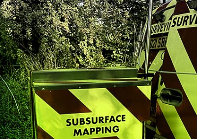
The term Utility Survey refers to the detection, identification, verification and location of buried pipes and cables. Commonly used terms include: Service Tracing, Buried Services Survey, Underground Utility Survey, Underground Utility Mapping and Utility Detection Survey.
A successful utility survey will rely on more than just a methodical collection of data using Ground Penetrating Radar (GPR) and Electromagnetic Location (EML). A rounded approach is needed to understand the buried services within the survey area. This requires experienced, well trained and suitably qualified staff.
In June 2014 BSI published BS: EN PAS 128:2014 Specification for underground utility detection, verification and location. The purpose of this Publicly Available Specification (PAS) is to set out clear and unambiguous provisions to those engaged in the detection, verification and location of active, abandoned, redundant or unknown utilities.
PAS128 is not written from the client’s perspective but is meant for use by practitioners (usually a surveyor, geophysicist or subsurface utility engineer). It aims to provide:
- Clarity in the service provided and methods employed
- Consistency in the approach to data capture
- Classification of the results and the confidence that can be associated with them
- Standardisation of the format of deliverables
- Accountability for the work undertaken
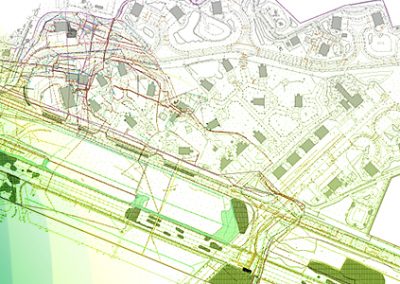
The precursor to all types of site based PAS128 surveys is the procurement of a desktop utility records search and the successful detection and mapping of buried utilities involves the combination of all of the robust techniques mentioned above.